Love the idea of a small-town feel with big-trail energy? If you’re weighing a move in the Boulder area, Louisville gives you everyday access to paths, open space, and an easy launch point to Boulder and Denver. You want a place that balances outdoor living with convenient commutes and a lively, family-friendly culture. In this guide, you’ll learn how Louisville’s trail network works, the realistic ways people get around, and what daily life feels like in and around downtown. Let’s dive in.
Where Louisville fits on the map
Louisville sits in Boulder County between Boulder to the northwest and the US-36 corridor toward Denver. It functions as a bedroom community for both job centers, yet it keeps a distinct, historic downtown and a tight-knit feel. Many residents choose Louisville for the blend of quiet neighborhoods, strong trail access, and quick connections to regional amenities.
If you plan to drive, your day-to-day experience will depend on when you travel. Getting into Boulder is typically a short, straightforward hop, while heading to central Denver can take longer during peak traffic. Always check real-time apps for current travel estimates and construction updates.
Trails and outdoor lifestyle
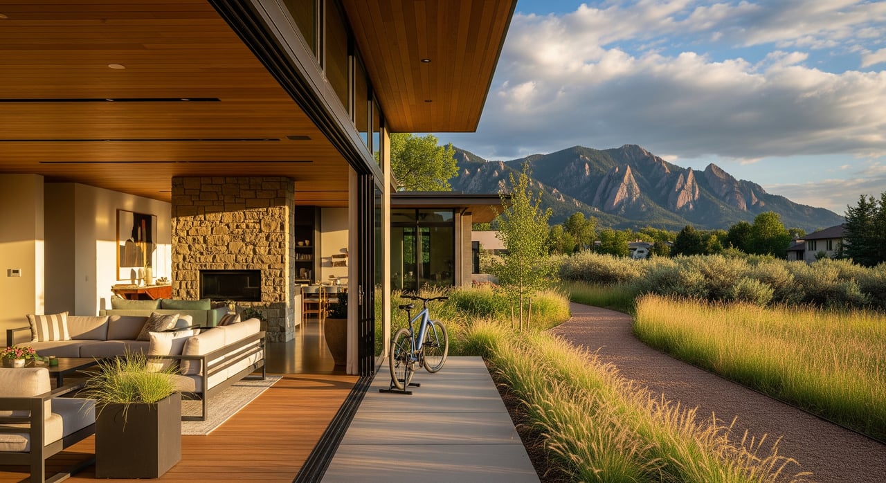
Louisville is known for neighborhood paths that make it easy to get outside without loading the car. You’ll find a mix of paved multi-use corridors and natural-surface paths, along with connectors that link homes to parks, schools, and downtown. It’s a lifestyle advantage for runners, cyclists, dog walkers, and anyone who wants a quick nature break between meetings.
Everyday paths and connectors
Across town, short connector trails tie residential streets to greenbelts, playgrounds, and local schools. Many of these routes are paved and well-signed, so you can move safely without relying on busy roads. If you have kids in sports or a stroller in tow, these neighborhood links make spontaneous outings simple and stress-free. For maps and updates, explore the City of Louisville’s Parks and Recreation resources on the City of Louisville official website.
Regional corridors and open space
The Coal Creek corridor is a key regional link that threads through neighborhoods and ties into broader Boulder County paths. From Louisville, you can reach county open space and connect into larger multi-use systems that extend toward Boulder and neighboring communities. If you enjoy longer rides or weekend hikes, start with Boulder County’s trail maps and guides from Boulder County Parks & Open Space.
Seasonal maintenance and closures
Trails here are generally well maintained, but conditions change with snow, runoff, and seasonal wildlife closures. The city and the county share maintenance and signage depending on the trail segment. Before a big run or ride, check for alerts on the City of Louisville website and regional updates through Boulder County Parks & Open Space.
How people commute
Louisville’s location gives you flexible commuting choices. Many residents drive to Boulder, Broomfield, or Denver tech hubs along US-36. Others rely on regional bus service, and a growing number use the trail and bike network for short-range commuting. Your ideal mix depends on your work schedule, parking arrangements, and comfort with active commuting.
Driving via US-36
US-36 is the main artery between Boulder and Denver. From Louisville, you can jump onto the corridor quickly and choose surface streets to reach local jobs in Louisville, Superior, or Broomfield. Traffic conditions vary by hour and season, so budget extra time for morning and afternoon peaks. For corridor updates and project information, consult the Colorado Department of Transportation.
Transit: Flatiron Flyer and local buses
The Flatiron Flyer bus rapid transit operates along US-36, connecting Boulder and Denver with stops that serve the Louisville area. It’s designed for commuters who want a reliable, express-style ride with Park-n-Ride access and frequent service during rush hours. Check schedules, maps, and fare information on the Regional Transportation District.
Direct rail service is limited in this part of Boulder County. Most riders who prefer rail connect via bus to regional stations or use Park-n-Ride facilities tied to the Flatiron Flyer for downtown Denver access.
Biking and rolling to work
If you work nearby, Louisville’s multi-use paths and designated bike routes can make two-wheeled commuting practical for part or all of your trip. You can stitch together neighborhood connectors with regional paths to reach employment centers in adjacent communities. For a hybrid approach, consider biking to a Park-n-Ride, then taking the Flatiron Flyer for the longer leg. This can save time on parking and reduce the stress of rush-hour driving.
Culture and downtown life
Louisville’s Old Town core offers independent shops, cafes, and restaurants wrapped in a walkable, historic setting. It is compact enough to do errands on foot and lively enough to keep your weekends full. Many community events and seasonal gatherings happen in and around downtown, creating an easy sense of belonging.
Downtown Louisville
Expect a low-key, local vibe with a mix of eateries, casual patios, and small retailers. Evenings and weekends are popular, and parking can be tighter during events, so plan to walk, bike, or arrive a bit early. The city’s online calendar is the best place to confirm dates and details for community happenings. For updates and civic programming, start with the City of Louisville homepage.
Schools, library, and community facilities
Public schools serving Louisville sit within established district boundaries, and assignments can vary by address. Always verify your address with official district tools and review performance information from the Colorado Department of Education. For a broad look at school profiles from a parent’s perspective, you can also explore GreatSchools. Louisville’s public library and recreation amenities add to daily convenience and community life; check the city’s site for current programs and hours.
Homes, neighborhood fit, and resale
Housing in Louisville ranges from historic homes near downtown to post-war and more recent subdivisions, plus condos and townhomes for lower-maintenance living. Proximity to trails, commute routes, and downtown walkability often drives demand. Because the Boulder metro generally commands higher prices than national averages, it pays to be strategic about features that support long-term value.
What buyers prioritize
- Direct access to multi-use trails or a short bike connection to regional paths.
- Easy access to US-36 or a quick route to a Park-n-Ride for the Flatiron Flyer.
- Walkability to downtown conveniences and community spaces.
- School assignment fit and proximity to parks, fields, and activities.
When comparing homes, think about your weekday routines. A house a few blocks closer to a connector trail, or with faster access to US-36, can pay off in day-to-day time savings.
Seller strategies that stand out
Sellers can highlight practical lifestyle advantages in their marketing. Call out nearby trail connectors, estimated walking minutes to downtown, and transit access. Clean, uncluttered staging helps buyers visualize an active, low-stress routine. If you have recent upgrades that support at-home wellness or gear storage, feature those in photos and your property description.
Practical tips and next steps
Use this quick checklist as you narrow your search:
- Verify commute times at your actual travel hours using a real-time mapping app.
- Download current trail maps and note the nearest connector from each target home. Start with Boulder County Parks & Open Space and the City of Louisville.
- Confirm school boundaries with the district and review state reports via the Colorado Department of Education. Use GreatSchools for additional context.
- Ask about seasonal trail maintenance and any planned city or county projects that could affect traffic or connectivity.
- Review environmental considerations like floodplains or wildfire awareness at Boulder County.
When you’re ready to explore homes that fit your lifestyle and your budget, connect with a local advisor who blends neighborhood insight with data-driven strategy. If you want thoughtful guidance on trade-offs between trail access, commute, and resale potential, reach out to Juli Kovats to start the conversation.
FAQs
How far is Louisville from Boulder and Denver for commuters?
- Most residents consider the drive to Boulder short and the trip to central Denver longer and traffic-dependent. Always check real-time apps for current conditions and incident delays.
What are the main trails in Louisville for daily use?
- You’ll find a network of paved multi-use paths and connectors, with the Coal Creek corridor serving as a core regional link. For maps and updates, start with the City of Louisville and Boulder County Parks & Open Space.
Which transit options connect Louisville to Denver and Boulder?
- The Flatiron Flyer bus rapid transit on US-36 and additional RTD bus routes offer frequent service to Boulder and Denver, with Park-n-Ride access. Check schedules and fares at the Regional Transportation District.
How walkable is downtown Louisville for daily errands and dining?
- Downtown Louisville is compact and pedestrian-friendly, with local shops and restaurants in a small historic core. Expect busier parking during events and peak dining hours, so consider biking or walking when possible.
How do I verify Louisville school assignments and performance?
- Confirm your address with the local school district and review official state data on the Colorado Department of Education. For parent-oriented profiles, see GreatSchools.
What should buyers focus on for long-term resale in Louisville?
- Proximity to trail connectors, commute convenience to US-36 or Park-n-Ride, walkability to downtown, and alignment with school boundaries are consistent resale drivers in this market.